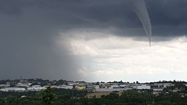
Seeing this kind of phenomenon is always spectacular. In the afternoon of Thursday, 24 June, a funnel cloud darkened the sky in the north of the Ardèche region in southeast France. According to the different photos posted on social networks, it was observable in the area of Annonay, the most populated city in the region.
Discover our latest podcast
An impressive sight
One of the most impressive images is certainly that of Erika Loursac. As she told the Dauphiné Libéré, the witness was on her lunch break when she observed the phenomenon.
I saw the tornado getting bigger and bigger.
Un orage se met en place entre annonay et la vallée du Rhône. Avec la présence d'un tuba. L'orage est stationnaire donc attention.
Posted by Météo Ardèche on Thursday, June 24, 2021
But it was not exactly a ‘tornado!’ As mentioned before, the term ‘funnel cloud’ is more accurate. What is the difference? Simply that the funnel does not touch the ground. A funnel cloud is nothing more than the start of a tornado.
No damage done
Interviewed by France 3, weather forecaster Frédéric Douay informed that it was ‘not [something] extraordinary. [Funnel clouds] can regularly be seen under super-thunderstorm cells.'
According to Erika Loursac, the Annonay funnel cloud lasted about 4 minutes. According to the Ardèche weather service, it didn't cause any damage.
Le tuba sur le bassin d'Annonay n'a pas touché le sol!!! Donc aucun dégât Photo Erika Loursac prise sur la page de Météo Ardèche
Posted by Météo Ardèche on Thursday, June 24, 2021
This purely visual spectacle must have been a relief for the inhabitants. France has had its fair share of violent meteorological phenomena recently. On Tuesday, 22 June, a spectacular tornado ripped the roof off a farm in the Doubs region. On Wednesday, 23 June, Beauvais, in the Oise region, suffered major flooding, which cost the life of a 17-year-old secondary school student.


